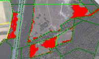
The analysis of complex images e.g. aerial images of periphery and downtown scenes is not possible with an approach only on sub-symbolic basis.
The interpretation of periphery and downtown scenes with the automatic extraction of the road network.
The use of a priori knowledge and the modeling of this knowledge in a semantic network to make the knowledge useable for an automatic image interpretation. GeoAIDA is a system for controlling the interpretation of remote sensing data for the purpose of land use analysis.

